

The Rhyd Ddu Path is one of two routes to the summit of Yr Wyddfa that ascend the western slopes of the Yr Wyddfa massif. It offers striking mountain scenery, especially towards Moel Hebog and the hills of Nantlle.
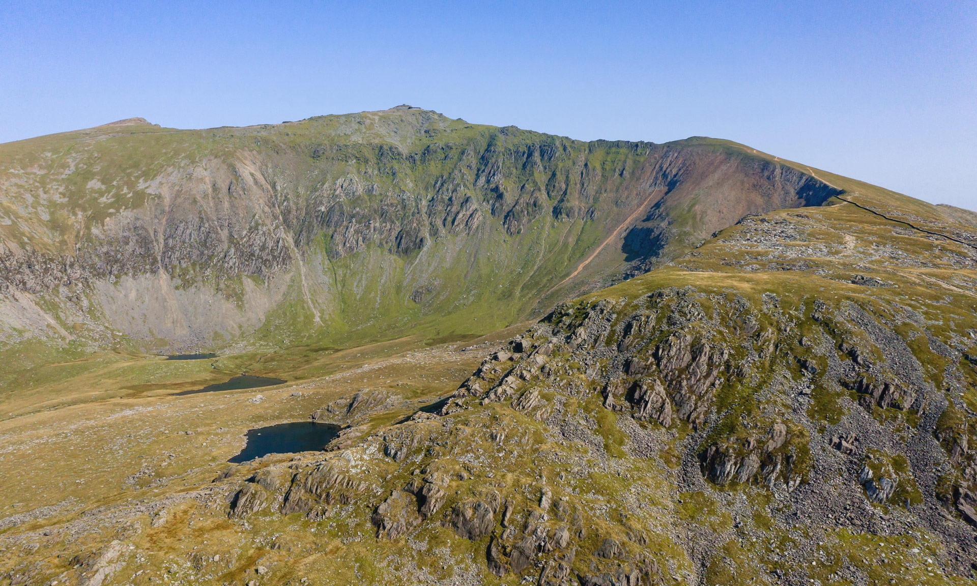
The first mile climbs gradually along the old track that served the Bwlch Cwm Llan slate quarry before ascending steeply over rocky terrain to Llechog ridge. The path follows the ridge towards Bwlch Main before the final climb to the summit.
Reaching the summit of Yr Wyddfa is a challenging undertaking. The National Park Authority classifies all of the routes up Yr Wyddfa as hard, strenuous routes. A good level of fitness is required, and navigation skills are essential.
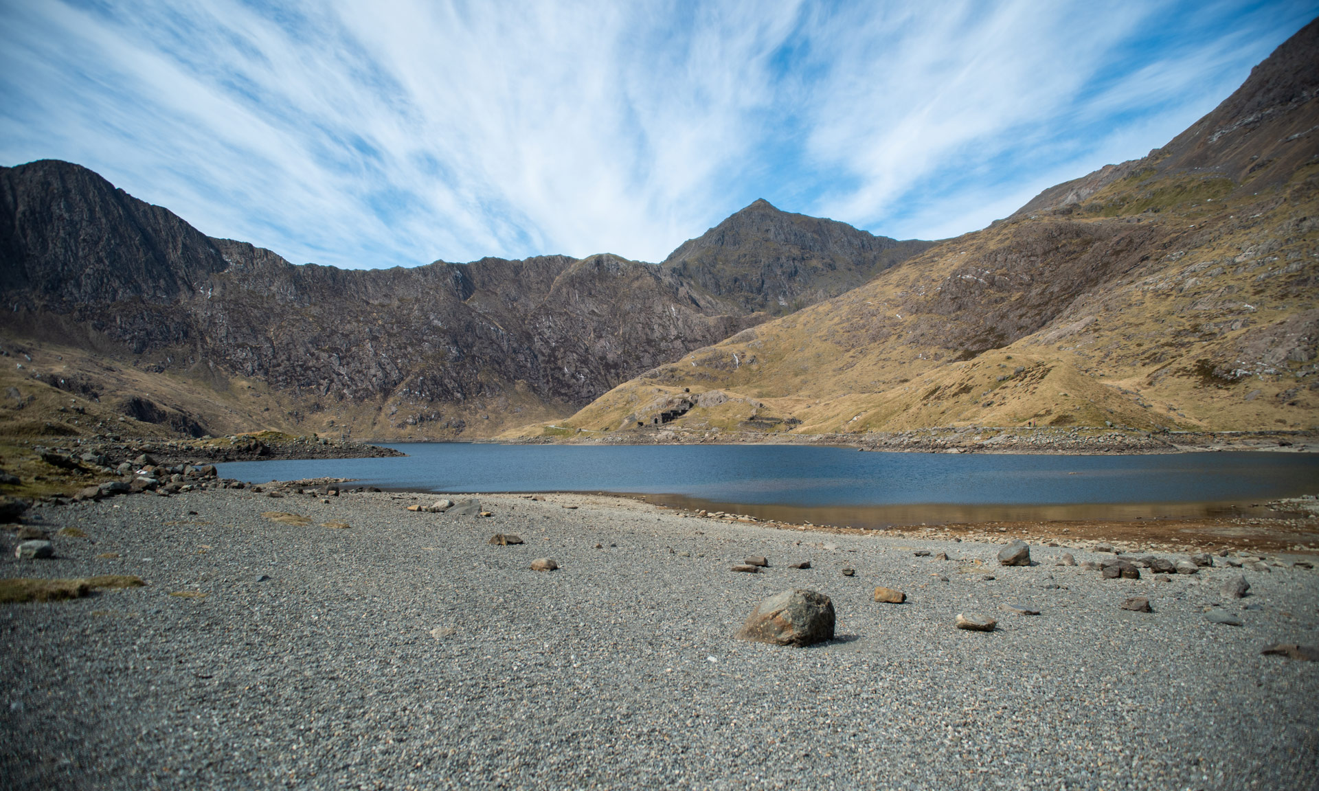
Some parts of Rhyd Ddu’s final section lead along a narrow and rocky path with steep slopes below. Extreme care must be taken on these parts. Only experienced walkers with specialised equipment should venture past this point during icy or winter conditions.
For up-to-date weather and ground conditions on Yr Wyddfa , please visit the official Yr Wyddfa Live website below.


© Crown copyright and database rights OS AC0000825604. Use of this data is subject to terms and conditions.
The National Park Authority has categorises this route as Hard/Strenuous. It is only suitable for experienced country walkers with a good level of fitness. Navigation skills are essential. The terrain will include steep hills and rough country and may include some sections of scrambling. Full hill walking gear is essential, and specialist equipment might be required under winter conditions.
Start / Finish
Rhyd Ddu Car Park, off the A4085 (SH 571 526)
Relevant OS Map
OS Explorer OL17 (Yr Wyddfa and the Conwy Valley)
Sherpa’r Wyddfa
The Sherpa’r Wyddfa bus service is a convenient service that stops at the trailhead of all six routes to the summit of Yr Wyddfa.
For the Rhyd Ddu Path, the best connections are from Caernarfon and Porthmadog.
Rhyd Ddu Path Bus Stop
Rhyd Ddu Station
For more information about getting to Yr Wyddfa, read the National Park Authority’s comprehensive ‘Getting to Yr Wyddfa’ guide or visit the Sherpa’r Wyddfa website.
Parking
Rhyd Ddu Station Car Park
Rhyd Ddu Station Car Park on Google Maps
If you’re using the Sherpa’r Wyddfa bus service:
Caernarfon Car Park on Google Maps
Porthmadog Car Park on Google Maps
Yr Wyddfa Ground Conditions Reports are now available on the Yr Wyddfa Live website.
Yr Wyddfa is a challenging mountain to hike. Venturing to the summit should not be taken lightly. Factors such as the seasons, your fitness level, your mountaineering skills, your preparations beforehand, and the mountain’s popularity can all affect your experience of Yr Wyddfa.
Charitable walks and events on Yr Wyddfa are a popular way to raise funds for various charities and organisations. However, you should always take care when taking part in such events. Climbing Yr Wyddfa isn’t an easy undertaking.
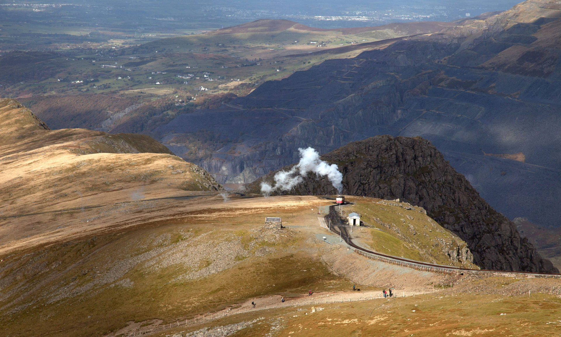
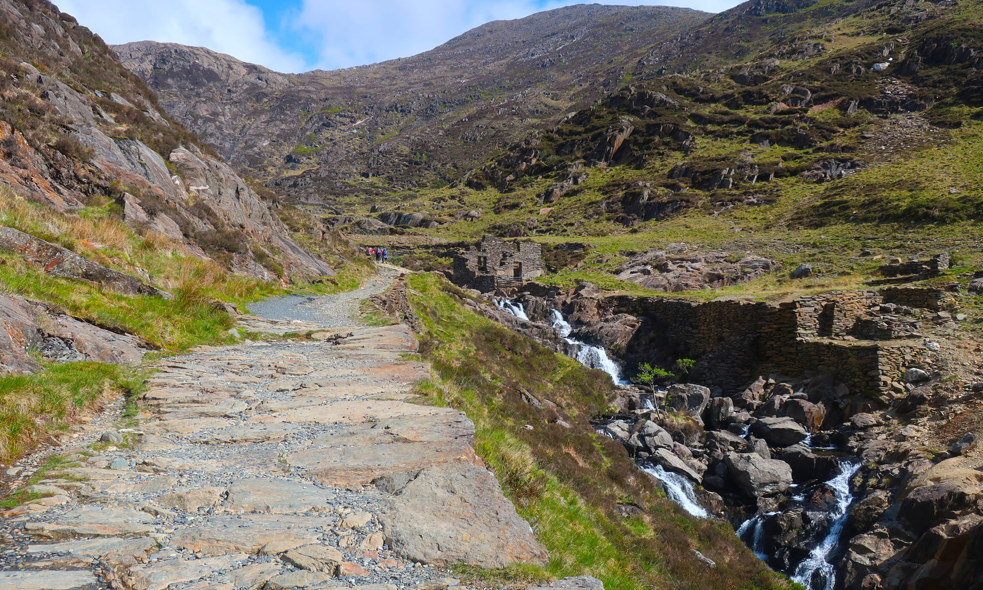
During the first part of the route, you will pass the remains of the Ffridd Slate Quarry, which was working until the 1860s. Signs of quarrying, mining and industry are visible across the slopes of Yr Wyddfa, including the South Yr Wyddfa Slate Quarry along the Watkin path and the Britannia Copper mine on the Pyg and Miners’ track.
Quarrying, mining and farming were the area’s main livelihood at one time, with villages such as Rhyd Ddu built entirely to house mining families. Farming continues to be one of the main livelihoods of the National Park today, and mountains such as Yr Wyddfa are home to a vast patchwork of hill farms.
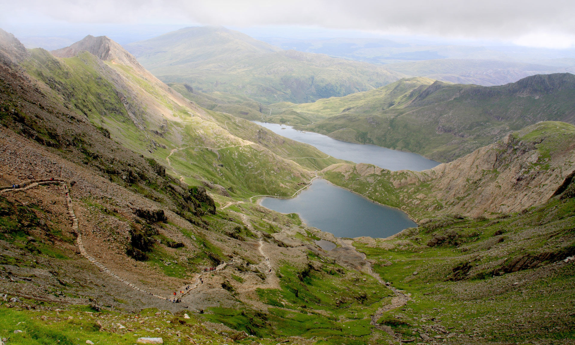
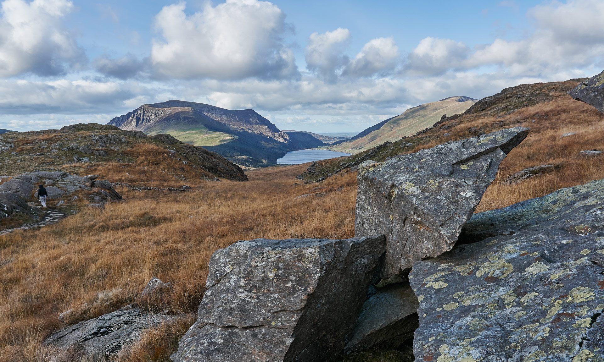
The route’s halfway point offers an opportunity to look down over the striking views of Rhyd Ddu with Llyn y Gadair and Llyn Cwellyn on each side of the village.
On the horizon, from left to right, are the summits of Moel Hebog, Moel yr Ogof, Moel Lefn, Mynydd Drws y Coed and Y Garn, with Mynydd Mawr rising from the far shore of Llyn Cwellyn.
Legend has it that Owain Glyndŵr, one of Wales’ most well-known princes, once hid from his enemies in a cave on the slopes of Moel yr Ogof. ‘Moel’ in Welsh means a bare, treeless mountain or hill, and ‘Ogof’ means cave.
According to the story, Glyndŵr was being pursued by English soldiers and climbed up a 300-foot rock crevice on Moel Hebog. The soldiers refused to climb the crevice after Glyndŵr, returning to nearby Beddgelert instead. Glyndŵr came across a cave where he hid until the soldiers returned to England. The cave has been known as Ogof Owain Glyndŵr ever since.